By Land …
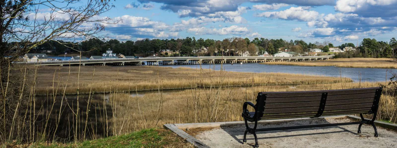
 The town of Smithfield and Isle of Wight County are located in Coastal Virginia. And no, we're not an island, but it is easy to get here, whether you're traveling by car, boat, air or rail. While you're on the way, you'll enjoy beautiful scenery and fantastic water views along the shores that helped found our nation. In fact, Genuine Smithfield is the #1 day-trip destination from Williamsburg and the Historic Triangle. Just a free ferry ride across the scenic and historic James River, and a 20-minute country drive puts you right in the heart of downtown Smithfield.
For GPS Directions, the address of our Visitor Center is 319 Main Street, Smithfield, Virginia.
The Colonial Trail
Visitors from Richmond and all points north might enjoy avoiding the interstates by taking the scenic and historic Colonial Trail to Smithfield. Beginning off Interstate 95-South in Richmond and then traveling along Route 10-East, the Colonial Trail winds through Hopewell and Surry County before arriving in Smithfield. This relaxing 90-minute journey will put you in the mood for the laid back vibe you'll enjoy once you arrive.
From Richmond and Washington D.C.
 Smithfield is 180 miles south of Washington D.C. (an approximately 3.5-hour drive) and only 70 miles from Richmond, Virginia (approximately a 90 minute drive) making it an easy day-trip destination from these cities.
By Sea ...
 Smithfield is located on the Pagan River which feeds directly into the James River. The directions listed below will get you and your water vessel to Smithfield Station Waterfront Inn and Marina. The Pagan has been dredged by the Army Corp of Engineers and the channel is maintained to a minimum depth of 10 feet, creating ample depth for vessels with 6-foot drafts to get up to Smithfield Station.
Proceed through the high rise draw at the James River Bridge;
Head for Days Point - the point of land on the far side of the mouth of the Pagan River. The Pagan River will be the first river opening on the left after the James River Bridge;
Look for the Red "2 Day" marker at the mouth of the Pagan River. Follow the day markers to the Pagan River to Smithfield Station.
As you continue on the Pagan River, follow the day markers closely. There are several shallow points off the channel.
The ferry crossing, which connects Jamestown to Scotland Wharf in Surry County, takes about 15 - 20 minutes. This free ferry ride is a great introduction to our area. When you stand at the bow, it's easy to imagine the excitement felt by our early colonists as they sailed the James River. After departing the ferry, take Route 10 east from Surry to Smithfield for about 18 miles, then turn left on Main Street at the intersection of Route 10 and Route 258 to the Visitor’s Center at 319 Main Street. Please note! Do not turn at the first directional sign for Smithfield found on Route 10, continue on to the traffic light at Main Street.
By Air ...
Smithfield & Isle of Wight County are easily accessible by air too. We're an easy drive from both Norfolk International Airport and Newport News/Williamsburg International Airport.
Norfolk International Airport (ORF)
2200 Norview Avenue
Norfolk, Virginia 23518-5807
757.857.3351
Newport News Williamsburg International Airport (PHF)
900 Bland Blvd., Suite G
Newport News, Virginia 23602
757.877.0221
Richmond International Airport is just 67 miles from downtown Smithfield, making it yet another great option for traveling to the area via air. Washington D.C. is 180 miles from Smithfield so even Washington Dulles International Airport and Ronald Reagan Washington National Airport are options for traveling to the area by air.
By Rail ...
The Newport News Amtrak Station (NPN) is located at 9304 Warwick Boulevard, Newport News, VA 23601, just across the James River Bridge from Isle of Wight County, making traveling by train to the area just as easy.
Distance between Suffolk, Virginia to Smithfield, Virginia is 20 miles if you take the fastest route via VA-10. It takes about 33 minutes to drive from Downtown Suffolk to Downtown Smithfield VA.
Driving Directions- Start at Suffolk, Virginia
- Head east on W Washington St toward N Main St for 85 ft
- Turn left at the 1st cross street onto N Main St for 2.2 mi
- Pass by KFC (on the left in 1.1 mi)
- Slight right onto VA-10 W/Godwin Blvd for 15.0 mi
- Continue to follow VA-10 W
- Pass by Wendy's (on the right in 14.8 mi)
- Take the Route 10/258 bypass
- Turn right at the light onto Main Street, Route 258
- Arrive at Smithfield, Virginia
Distance between Smithfield, Virginia to Jamestown, Virginia is 25.7 miles if you take the free ferry across the James River. It takes about 28 minutes to drive from Smithfield VA to the ferry entrance. The ferry averages about 20 minutes to cross and arrives in Jamestown.
Driving Directions- Start at Smithfield, Virginia
- Take VA-10 W to State Rte 634 in Bacons Castle
- Take State Rte 636 to VA-31 N in Surry
- Take the Jamestown - Scotland ferry
- Arrive at Jamestown, Virginia
Distance between Smithfield, Virginia to Jamestown, Virginia is 46 miles if you take the fastest route via I-64 W. It takes about 60 minutes to drive from Smithfield VA to Jamestown VA.
Driving Directions- Start at Smithfield, Virginia
- Take N Church St, Battery Park Rd and State Rte 669 to US-17 N/US-258 N in Carrollton for 6.9 mi
- Continue on US-17 N/US-258 N. Take I-64 W to VA-199 W in District 1. Take exit 242A from I-64 W for 29.2 mi
- Continue on VA-199 W. Take Jamestown Rd to Island Drive in Jamestown for 10.4 mi
- Arrive at Jamestown, Virginia
Distance between Portsmouth, Virginia from Smithfield, Virginia is 26 miles if you take the fastest route via US-258 N, US-17 S and VA-164 E. It takes about 36 minutes to drive from Smithfield VA to Portsmouth VA
Driving Directions- Start at Smithfield, Virginia
- Follow Main St to US-258 N for 0.6 mi
- Follow US-258 N, US-17 S and VA-164 E to VA-141 S/London Blvd in Portsmouth. Take the VA-141 S/London Blvd exit from US-58 W for 24.1 mi
- Follow London Blvd to your destination
- Arrive at Portsmouth VA
Distance between Smithfield, Virginia to Jamestown, Virginia is 25.7 miles if you take the free ferry across the James River. It takes about 28 minutes to drive from Smithfield VA to the ferry entrance. The ferry averages about 20 minutes to cross and arrives in Jamestown.
Driving Directions- Start at Smithfield, Virginia
- Take VA-10 W to State Rte 634 in Bacons Castle
- Take State Rte 636 to VA-31 N in Surry
- Take the Jamestown - Scotland ferry
- Arrive at Jamestown, Virginia
Distance between the Historic Triangle, Virginia To Smithfield, Virginia is 148 miles if you take the fastest route via I-95 S and VA-10 E. It takes about 2 hour 30 minutes (approximately) drive to reach your destination.
Driving DirectionsThese directions are incorrect. I would suggest you start the directions from Colonial Williamsburg
- Start at Colonial Williamsburg,, Virginia
- Get on I-95 S for 0.9 mi
- Continue on I-95 S to Henrico. Take exit 22A from I-295 S for 86.9 mi
- Follow VA-5 E and VA-10 E to N Church St in Smithfield for 59.9 mi
- Arrive at Smithfield, Virginia
Distance between Staunton, Virginia To Smithfield, Virginia is 178 miles if you take the fastest route via I-64 E and VA-10 E. It takes about 3 hours (approximately) drive to reach your destination.
Driving Directions- Start at Staunton, Virginia
- Get on I-81 S from Richmond Ave for 2.7 mi
- Take I-64 E to VA-10 E/W Hundred Rd in Chester. Take exit 61A from I-95 S for 118 mi
- Follow VA-10 E to Main St, 258 in Smithfield for 57.0 mi
- Arrive at Smithfield, Virginia
Distance between Smithfield, Virginia to Jamestown, Virginia is 25.7 miles if you take the free ferry across the James River. It takes about 28 minutes to drive from Smithfield VA to the ferry entrance. The ferry averages about 20 minutes to cross and arrives in Jamestown.
Driving Directions- Start at Smithfield, Virginia
- Take VA-10 W to State Rte 634 in Bacons Castle
- Take State Rte 636 to VA-31 N in Surry
- Take the Jamestown - Scotland ferry
- Arrive at Jamestown, Virginia
- Follow VA-31 Jamestown Road to your destination
Distance between Williamsburg, Virginia to Smithfield, Virginia is 40 miles if you take the fastest route via I-64 E. It takes about 50 minutes (approximately) drive to reach your destination.
Driving Directions- Start at Williamsburg, Virginia
- Take Lafayette St to US-60 E/York St for 1.5 mi
- Take I-64 E, Jefferson Ave and US-17 S/US-258 S to State Rte 669 in Carrollton for 31.6 mi
- Continue on State Rte 669. Take Battery Park Rd to S Church St
- Turn right at S Church St
- Arrive at Smithfield, Virginia
Distance between Ashburn, Virginia to Smithfield, Virginia is 200 miles if you take the fastest route via I-95 S. It takes about 3 hours (approximately) drive to reach your destination.
Driving Directions- Start at Ashburn, Virginia
- Get on VA-267 E in Dulles from State Rte 642 and VA-901 for 2.9 mi
- Continue on VA-267 E. Take I-95 S and I-295 S to VA-5 E in Henrico. Take exit 22A from I-295 S for 137 mi
- Follow VA-5 E and VA-10 E
- Turn left onto 258 Main St in Smithfield and arrive at your destination
Distance between Virginia Beach to Smithfield, Virginia is 45 miles if you take the fastest route via I-264 W. It takes about 53 minutes (approximately) drive to reach your destination.
Driving Directions- Start at Virginia Beach
- Take Arctic Ave and 22nd St to I-264 W/Norfolk Virginia Beach Expy/Virginia Beach Expy for 0.8 mi
- Follow I-264 W and VA-164 W to Bridge Rd in Suffolk for 28.5 mi
- Continue on Bridge Rd. Take US-258 S to Main St in Smithfield and arrive at your destination
Distance between Norfolk VA to Smithfield, Virginia is 28 miles if you take the fastest route via I-264 W. It takes about 36 minutes (approximately) drive to reach your destination.
Driving Directions- Start at Norfolk, Virginia
- Get on I-264 W from E Freemason St for 0.6 mi
- Take VA-164 W, Bridge Rd, US-17 N and US-258 S to Main St 258 in Smithfield for 25.0 mi
- Turn right onto Main St in Smithfield and arrive at your destination
Distance between Fredericksburg VA to Smithfield, Virginia is 131 miles if you take the fastest route via I-95 S and VA-10 E. It takes about 2 hours 15 minutes (approximately) drive to reach your destination.
Driving Directions- Start at Fredericksburg, Virginia
- Get on I-95 S from Lafayette Blvd, Blue and Gray Pkwy, William St and Plank Rd for 3.7 mi
- Follow I-95 S and I-295 S to VA-5 E in Henrico. Take exit 22A from I-295 S for 67.0 mi
- Follow VA-5 E and VA-10 E to Main St 258 in Smithfield and arrive at your destination
Distance between Richmond VA to Smithfield, Virginia is 71 miles if you take the fastest route via VA-10 E. It takes about 1 hour 25 minutes (approximately) drive to reach your destination.
Driving Directions- Start at Richmond, Virginia
- Get on I-95 S for 0.8 mi
- Take exit 61A onto VA-10 E to Main St in Smithfield and arrive at your destination
Distance between Chesterfield, VA to Smithfield, Virginia is 66 miles if you take the fastest route via VA-10 E. It takes about 1 hour 20 minutes (approximately) drive to reach your destination.
Driving Directions- Start at Chesterfield, Virginia
- Take Government Center Pkwy to Courthouse Rd for 0.8 mi
- Follow VA-288 and VA-10 E to Main St 258 in Smithfield and arrive at your destination
Distance between Bluemont VA to Smithfield, Virginia is 200 miles if you take the fastest route via I-95 S. It takes about 3 hours 35 minutes (approximately) drive to reach your destination.
Driving Directions- Start at Bluemont, Virginia
- Take State Rte 611 to US-50 E for 12.9 mi
- Take US-17 S, I-95 S and I-295 S to VA-5 E in Henrico. Take exit 22A from I-295 S for 127 mi
- Follow VA-288 and VA-10 E to Main St 258 in Smithfield and arrive at your destination
Distance between Chesapeake VA to Smithfield, Virginia is 32 miles if you take the fastest route via VA-164 W. It takes about 41 minutes (approximately) drive to reach your destination.
Driving Directions- Start at Chesapeake, Virginia
- Follow Pvt 7 Rd to Bainbridge Blvd for 0.1 mi
- Take I-464 N, VA-164 W, Bridge Rd, US-17 N and US-258 S for 29.7 mi
- Continue on Bridge Rd. Take US-258 S to Main St in Smithfield and arrive at your destination
Distance between Raleigh NC to Smithfield, Virginia is 169 miles if you take the fastest route via I-95 N. It takes about 2 hours 40 minutes (approximately) drive to reach your destination.
Driving Directions- Start at Raleigh, North Carolina
- Get on I-440 E from Capital Blvd for 4.0 mi
- Follow US-64 E and I-95 N to US-58 E in Emporia. Take exit 11A from I-95 N for 102 mi
- Follow US-58 E, State Rte 616 and State Rte 620 to Main St 258 in Smithfield and 62.8 mi and arrive at your destination
Distance between Petersburg to Smithfield, Virginia is 54 miles if you take the fastest route via I-95 N. It takes about 1 hour 10 minutes (approximately) drive to reach your destination.
Driving Directions- Start at Smithfield, Virginia
- Head southeast on N Church St toward Main St for 26 ft
- Continue on Main St to Hardy for 2.4 mi
- Turn right onto State Rte 620 for 14.4 mi
- Continue on US-460 W. Drive to E Washington St in Petersburg for 36.5 mi and arrive at your destination
Distance between Rhinebeck, New York to Smithfield VA is 510 miles if you take the fastest route via I-95 S. It takes about 8 hours (approximately) drive to reach your destination.
Driving Directions- Start at Rhinebeck, New York
- Get on I-87 S/New York State Thruway in Ulster from Mt Rutsen Rd, NY-199 W and US-209 S for 12.5 mi
- Continue on I-87 S. Take Garden State Pkwy, I-95 S, NJ Tpke S, I-95 S, ... and I-295 S to VA-5 E in Henrico. Take exit 22A from I-295 S for 438 mi
- Follow VA-5 E and VA-10 E to Main St 258 in Smithfield and arrive at your destination
Distance between Chesterfield Va to Smithfield VA, is 66 miles if you take the fastest route via VA-10 W. It takes about 1 hour 20 minutes (approximately) drive to reach your destination.
Driving Directions- Start at Smithfield, Virginia
- Take VA-10 W and VA-288 N to Frith Ln in Chesterfield for 65.9 mi
- Take Lori Rd to Mimms Loop for 0.7 mi and arrive at your destination
Distance between Chesterfield Va to Smithfield VA, is 48 miles if you take the fastest route via I-264 E. It takes about 1 hour (approximately) drive to reach your destination.
Driving Directions- Start at Smithfield, Virginia
- Get on VA-164 E in Suffolk from US-258 N and US-17 S for 16.4 mi
- Follow VA-164 E and I-264 E to 21st St in Virginia Beach for 28.6 mi
- Take Pacific Ave and General Booth Blvd to your destination for 2.8 mi and arrive at your destination